Directions
Angel Lake WR-19 is located in Duchesne County, Utah. It lies within the Whiterocks River Drainage on the south slope of the Uinta Mountains. From Highway 40 in Fort Duchesne turn north at the Eagleview Elemntary School onto White Rocks Highway. This is across the street from Bottle Hollow Reservoir. This road will also be called Farm Creek Road. Follow it for 20.6 miles north. Turn west onto Elkhorn Loop. There will be a sign which I usually blow past and have to backup. The sign will say Elkhorn Loop, Pole Creek Chepeta. From this point on it will be a dirt road. The road will become FR-117. Follow it up the mountain for 14.1 miles. You will come to a fork near Pole Creek Lake and turn onto FR-110 towards Chepeta Lake. Take FR-110 for 3.4 miles. If you have a truck park in the camp spot just below FR-235.
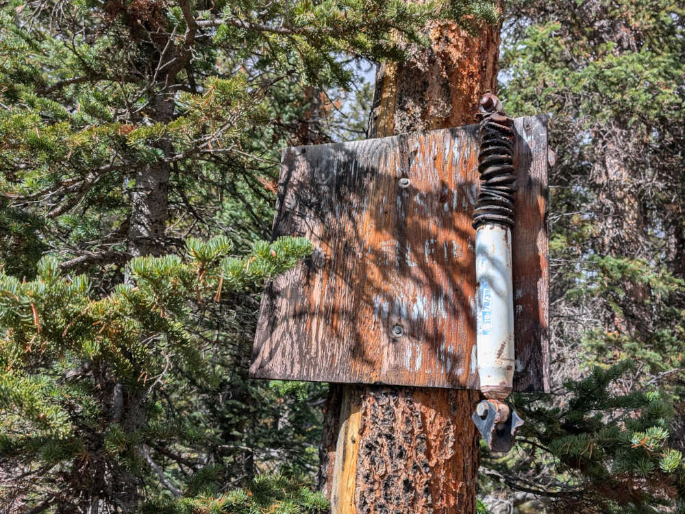
FR-235 is the road which leads to the trailhead. When I was last here in 2025, there was no sign for FR-235. If you see the road for West Fork Whiterocks trailhead FR-109 you have gone to far. FR-235 is 0.2 miles south of FR-109. FR-235 is called a OHV trail by the DWR for good reason. Don’t take a truck up this road unless you want to break it. Follow F-235 for 0.5 miles. There will be a old road that heads south and turns into a campsite before turning into a trail. Follow the creek which may be dry to the lake. I believe the hike is around 0.3 miles.
Fish Info
Likely Catch: Arctic Grayling
Possible Catch: Tiger Musky, and Colorado River Cutthroat.
In 2020 gill net studies showed a declining size in the grayling, indicating overpopulation. There was zero cutthroat caught during the 2020 gill net survey, despite recent stocking. It was recommended to stock a predator species in order to control the overabundance of grayling. Tiger Musky were introduced in 2022, and stocked again in 2024. Cutthroat will not be stocked until the Tiger Musky have controlled the population of grayling.
CTYL = Yellowstone Cutthroat. BK = Brook. CTCR = Colorado River Cutthroat. TGM = Tiger Musky. GRY = Grayling.
| Year | Species | Number Stocked |
| 1967 | CTYL | 5006 |
| 1975 | BK | 998 |
| 1981 | CTYL | 1,102 |
| 1986 | CTYL | 1,038 |
| 1989 | CTYL | 1,000 |
| 1992 | CTYL | 1,009 |
| 1997 | GRY | 1,265 |
| 1999 | CTCR | 994 |
| 2001 | CTCR | 983 |
| 2004 | CTCR | 986 |
| 2006 | CTCR | 738 |
| 2009 | CTCR | 980 |
| 2013 | CTCR | 1,038 |
| 2016 | CTCR | 545 |
| 2019 | CTCR | 506 |
| 2022 | TGM | 100 |
| 2024 | TGM | 150 |
Historical DWR Info
2024
Angel Lake, WR-19
Angel Lake sits at an elevation of 10,407 feet, has a maximum depth of 17 feet and is 11.4 surface acres. The lake is located at the bottom of a shallow cirque 0.7 mile south of the West Fork Whiterocks Trailhead. Intermittent springs are located on the west side of the lake. The area surrounding the lake is quite rocky. There is no horse feed and campsites are very scarce. The closest access is from the Rassmussen Lakes OHV trail. This OHV trail begins 0.2 mile south of the road to the West Fork Whiterocks Trailhead on the west side of the Chepeta Lake Road. Follow the OHV trail for about 0.5 mile to the second left fork in the road. Take the second fork from the main Rassmussen Lake road and follow for 0.1 mile to another fork. Take this for a couple hundred yards and park. From this point the lake lies approximately 0.3 mile in a southwesterly direction. Find the sparsely marked trail or scramble through timber and boulders to get to the lake. Angel Lake contains a naturally reproducing grayling population and is stocked periodically with cutthroat trout. Fishing pressure is moderate on this regularly visited water.
1987
ANGEL LAKE, WR-19. This natural lake lies at the bottom of a shallow cirque 0.7 miles south of the West Fork Trailhead. Horseback access up a rocky, timbered slope is difficult. Angel Lake is 10.4 acres, 10,407 feet in elevation, with a maximum depth of 17 feet. The surrounding area is quite rocky. There is no horse feed and campsites are very scarce. Intermittent springs are located on the west side of the lake. Angel Lake is stocked periodically with cutthroat trout but apparently winterkills on occasion. Fishing pressure is light on this seldom visited water
1964
W R-19. 10 acres, elevation 10,500 feet, maximum depth 18 feet, average depth 8 feet. Two miles north of Pole Creek Lake around the east side of the rock slides. No trail to the lake. Very rockv, timbered terrain. Poor campsites with no horse feed. Some large, wary cutthroat trout inhabit this lake. Seldom visited. Stocked periodically with curthroat.
Nearby Places To Fish
Rasmussen 1, Rassmussen 2, Cirque, Becky, Eric, Nellie, Ann, Tamara, Pole Creek Lake, Point, RC #1, Deadfall, Hidden, Chepeta lake and Walk-up Lake WR-55.

