
Directions
Azure Lake A-11 is located in the Provo River Drainage of the Uintas Mountains in Summit County, Utah. The lake can only be accessed by hiking. You can drive to either Beth Lake or hike past Haystack Lake. This area is located just off of the Mirror Lake Highway.
You can access the lake from Spring Canyon Road. The road is officially called FR-041 and Google maps labels this as Trial Lake rd. FR-041 first entrance is across the street from the Duchesne Tunnel. This is the longer route. The faster route would be the Washington Lake/Trial Lake turn off. From Mirror Lake highway take the Trial Lake exit and continue on FR-041 for 2.2 miles. This will put you at the trail for Haystack Lake which is my preferred route. Last time I was here in 2025 the trail marker was gone and it was difficult to see the trail head without GPS.
The other route is from Beth Lake. Continue past the Haystack Lake trail head a half mile on FR-041 and take FR 961 to Beth Lake. There is a small parking lot at Beth Lake.
The Hike
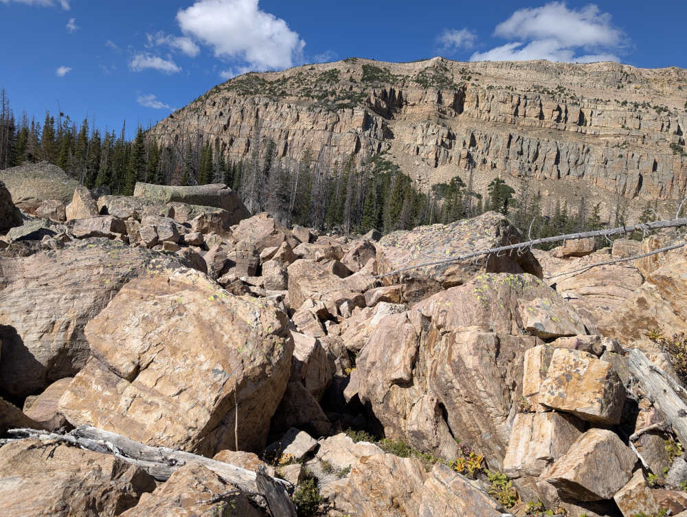
HIKE WARNING. Do not attempt this hike if you’re not in great shape or do not like scaling over hundreds of giant boulders. I strongly recommend you do not take small children on this hike as it can be dangerous.
From Haystack Lake
From the south side of Haystack Lake there is a small cattle fence. It runs somewhat east to west. This fence pretty much points to Azure Lake. You can walk along this and keep heading west towards Haystack Mountain and you will hit the Azure Lake. The first part of the hike goes straight up a hill but isn’t hard. The last 10% of the hike is going over large boulder fields. This part of the hike is pretty sucky. It appears from Google Maps that you hike south for 1/4 a mile then head west you might be able to miss the boulder field. From what I could see though the boulders were pretty much every where.
From Beth Lake
From the parking lot on the east side you will head west past Beth. You want to aim for the trees on the north as there are a lot of marshes near Beth that will soak your legs up to your shins. Head towards Haystack Lake to avoid the marshes until you’re past Beth. Then head west towards Haystack Mountain. Just look for the tallest peak and head that direction.
Fish Species
Likely catch Artic Grayling possible catch Tiger Trout.
Arctic Grayling were stocked in 2021, and 2020. I didn’t see any stocking history of tiger trout in the lake. Although i have seen tiger trout caught here. Rock lake which is a few hundred yards away is stocked with tiger trout every other year. Depending on time period or map Azure and Rock lake switch places.
Azure or Rock?
Originally the names of Rock Lake and Azure Lake were flipped on the map. Which you can see from the two DWR Lake of The High Uintas pamphlets I quote below.
According to a Deseret News article from 1997.
Visiting officially named Azure and Rock lakes shows why the names should be reversed.
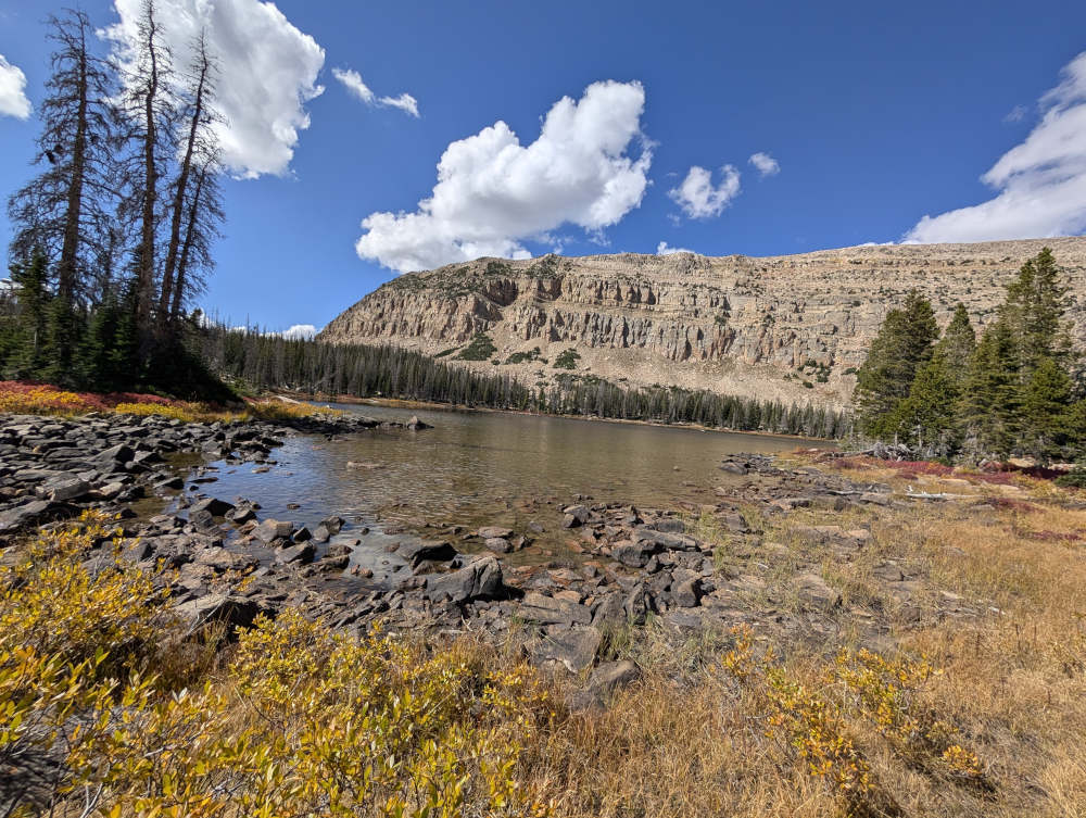
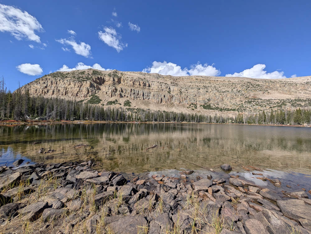
Located less that 100 yards from each other, the eastern lake – Azure – is actually the one with rocks all around it and even a few large boulders cropping up in the water. Rock Lake to the west, meanwhile, has grasses growing all around it and is partially surrounded by pine trees.
Clegg said this misnamed Rock Lake is the true Azure Lake because of the poignant sky-blue color it assumes under a clear sky.
Historical DWR Info
1999
AZURE, A-II. Azure is a natural lake located in a glacial basin formed by an end moraine of large boulders. It is 9 acres, 10,140 feet in elevation, with 23 feet maximum depth. The surrounding terrain is rocky and talus slopes flank the western and northern margins of the lake. Campsites, horse feed and spring water are not available at Azure. Better opportunities are present at nearby Rock Lake. Azure is located 3/8 mile west of Haystack Lake and approximately 200 yards north and slightly west of Rock Lake. Access is limited to backpackers due to the presence of large rockslides. Recreational use is very light. Azure is not being managed for a fishery.
1964
AZURE, A-10. 10 acres, elevation 10,000 feet, maximum depth 15 feet, average depth 8 feet. Record of winter kill. Sits in rocky timbered country. Produces good fishing for Eastern brook. Seldom fished. West 1/2 mile off Spring Creek Road by Haystack No. 1 Lake. Too rocky for good campsites. Stocked.
Nearby Places to Fish
Rock Lake is a short hike to the east. Access from the north west side of Azure to try and avoid the Rasberry Rock Field.
Shadow Lake is located a few hundred yard north of Rock Lake and across a bunch of boulders. Other nearby Lakes are listed on the map below but include.
Haystack Lake, Beth Lake, Blue Lake, Tail Lake, Washington Lake, Trident Lake, Buckeye, Spectacle, Alexander, Lambert, and Trial.