
Directions
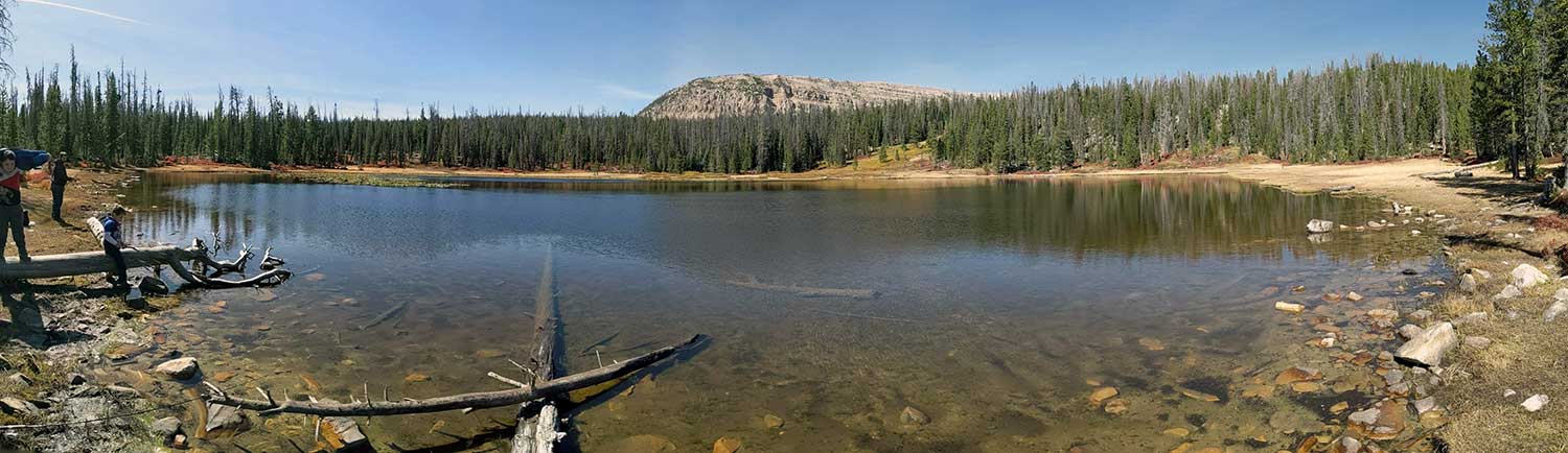
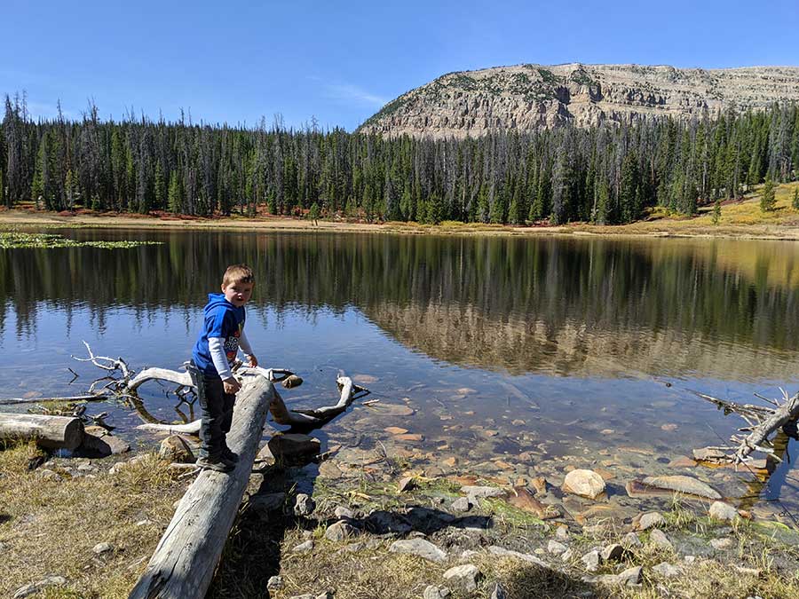
Beth Lake A-6 is located in the Provo River drainage of the Uinta-Wasatch-Cache National Forest. This part of Utah is typically refereed to as the Uintas. Beth Lake sit just off the Spring Canyon Road of the Mirror Lake Highway. There is two entrances the south entrance which is the Alexander Lake turn off. The north entrance is the Trial Lake turn off.
South Entrance. From Kamas take the Mirror Lake highway for 17.8 miles to the Spring Canyon Road FR-041 exit. This exit can sneak up on you. It is across the street from the Duchesne Tunnel. You should see a sign for Alexander Lake. The first mile of this road is known to have a few rocks so I wouldn't recommend a low clearance car. Follow Spring Canyon Road/Trial Lake road for 6.6 miles. Then take FR 961 for a few hundred feet.
North Entrance. This route is quicker and typically a smoother dirt road then the south entrance. From kamas take the Mirror Lake highway for 25.4 miles. You will see a sign for Trial Lake or Spring Canyon road FR-041. Follow Spring Canyon Road/FR-041/Trial Lake Road for 2.7 miles. Turn onto FR 961 for a few hundred feet.
There is a dirt parking lot with a trail that is a few hundred feet down the hill to the lake.
Spring Canyon Road 9.3 miles of beautiful places to see also known as Trial Lake road. Although it add time onto the journey I like to drive the complete road from north to south entrance. There are many places to fish along this road.
Fish
Brook Trout is the only known species of fish in this lake. The DWR typically stocks this lake yearly with around 300 of the 3" brook trout fish.
Hikes
Haystack Mountain lies just beyond Beth lake. Read more about the hike from the Girl On A Hike site.
Bigfoot
The Deseret News had the following to say about a possible Bigfoot in the area.
July 2006 — A man and other witnesses in the high Uintas near Beth and Trident lakes heard screams at night that they said could have come from a bigfoot.
Reenactment photo of possible bigfoot.
Historical DWR Info
1999
BETH, A-6. Beth is a shallow, productive lake with an open shoreline and floating grassy banks. It is 5.4 acres, 9,780 feet in elevation, with 10 feet maximum depth. The lake is surrounded by wet meadows. Access is 6 1/2 miles north on the Spring Canyon Road from U-150 and then west for 1/4 mile on a marked spur road. There are several good campsites available with areas for mobile camping units. Spring water is unavailable. Horse pasture is present in surrounding meadows but is quite boggy. Beth contains a good population of brook trout. Fisherman use is heavy.
1964
BETH, A-6. 6 miles north on Spring Creek Road past Buckeye Lake. 10 acres, elevation 9,700 feet, average depth 4 feet. A pretty lake in open country surrounded by timber. Eastern brook. Stocked. Good fly fishing in late evenings. Camping places.
Nearby Places to Fish
Haystack Lake is a short hike to the northwest.
Trident Lake is 0.3 miles to the southwest. Just head down FR -41 Spring Canyon Rd and you will see it's marshy shores to the west.
Blue Lake From FR -041 take a very rough and rocky FR - 531 for just under a mile. High clearance vehicle is a must. Everyone I've talked to said the only bite you will get here is mosquitos and the crappy road is not worth your time.
Buckeye Lake 1.8 miles south on FR-041. Then turn onto FR-531 for a few hundred feet.
Spectacle Lake, Lambert Lake, and Alexander Lake are just south of Buckeye.
Hiking to the north west you will hit Azure, Rock Lake, Shadow and Tail Lake.
If you go north on FR-41 you will hit the bigger lakes like Washington and Trial. There are several lakes you can hike to from this area.