
Directions
Big Elk Lake A-18 is located in Summit County, Utah. The lake is part of the Provo River Drainage in the Uinta-Wasatch-Cache National Forest. The primary entrance is from the Norway Flats road. Other popular access points are from the Upper Setting Trail, and Smith and Morehouse Trail. You can also access from Island Lake although there is no trail and most people don't choose this route. You can read about the hikes below.
The Hikes In
Norway Flats
Big Elk Lake Trail is 3 to 5 miles round trip hike depending on where you park.
From Kamas take Mirror Lake Highway for 10.6 miles to the Norway Flats turnoff. The Norway Flats road also called Forest Road 035, starts out as a washboard dirt road and gets rougher the further up you get. Most people drive until the road gets really rough then pull over and hike the remainder of the way. Once you get to the last couple miles of Forest Road 035 the road is full of sharp slate rocks. This road has a strong history of popping tires. If you want to drive to the end of it be prepared to lose a tire.
FR 035 is about 6.5 miles long, from Mirror Lake highway to the end near Little Elk Lake. Some older maps falsely show FR 035 B as going all the way to Big Elk Lake. Do not take FR 035 B it just leads to pain, suffering and broken vehicles. Most people choose to park about 1 mile before the road ends. One of the area's I like to park at is Forest Road 916 which is 5.5 miles up FR 035. Forest Road 916 only goes back in a few hundred yards to a little pond.
From Forest Road 916 the hike to Big Elk Lake is 2.5 miles. The elevation climbs from 9,600 feet to 10,000 feet. Just continue on Forest Road 035A. After FR 035 ends, the trail can be spotty, so I recommend bringing a GPS. Most of the elevation gain is in the last half mile of the hike.
Upper Setting Trail
The Upper Setting Trail is 7.5 miles round trip hike.
From Mirror Lake Highway take the Upper Setting Road for 6.7 miles until the road ends. The road can get a bit rough the last mile or two and a medium clearance vehicle is recommended. The Upper Setting Trailhead starts at the end of the road. The first 1.6 miles to East Shingle Creek is an easy hike.
The next mile to South Erickson Lake the elevation increases by 400 feet and the hike gets a bit tougher. From South Erickson the elevation gains nearly 300 feet the half mile climb over the pass. Keep heading east and do not try to short cut the trail.
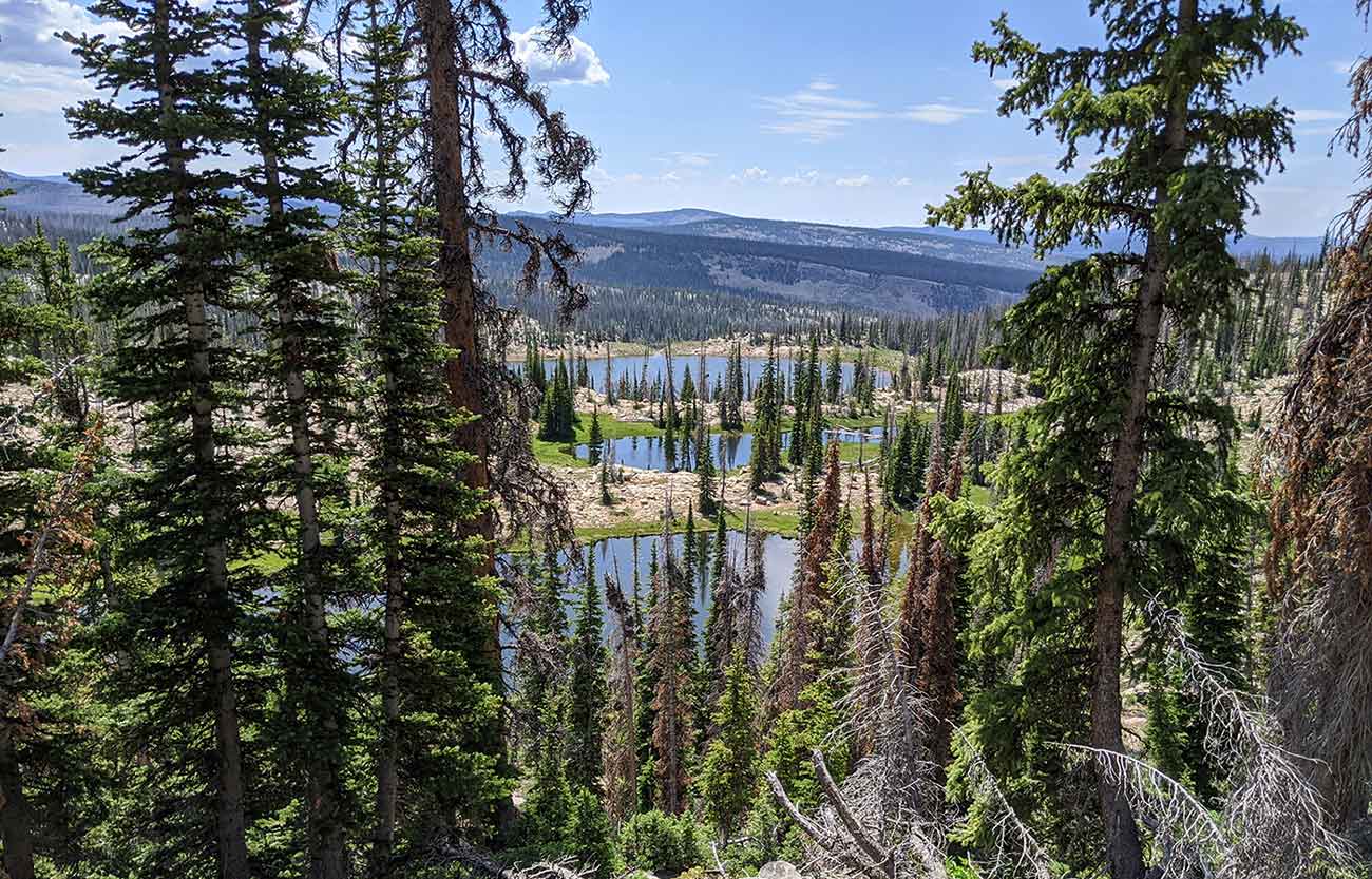
The final half mile drop down isn't too bad if you can stay on trail. The problem is the trail is non existent in a lot of places. Some one was nice enough to make some cairns on the best route down. If you follow these you shouldn't have to much of a problem. If you can't find the cairns then stay on the east side of the top two salamander ponds. Going west leads to several 20 foot cliffs so aim for the east side of the lake not the north bank. From the pic below you walk left of the first two ponds.
Smith and Morehouse Trail to Erickson Basin Trail
Erickson Basin Trail about 12 miles round trip hike.
From Smith and Morehouse reservoir head south past the Ledge Fork Campground to the trail head. Follow the Smith and Morehouse trail for 2.7 miles. Take the Erickson Basin Trail. Alternatively, you can continue on the Smith and Morehouse trail and do the loop past Island Lake. This loop will add a few miles though. Follow the Erickson Basin trail for 2.3 more miles to North Erickson Lake. From here travel 1/4 of a mile south up the hill to South Erickson Lake. This merges with the Upper Setting Trail and you can follow the directions in the section above.
Fish Species
There are wild breeding populations of cutthroat trout and brook trout. Tiger trout are stocked on a 3 to 5 year cycle. When I was here in 2020 I witnessed a splake being caught. Splake are not listed as being stocked here but I'm certain it wasn't a brook trout.
Historical DWR Info
1964
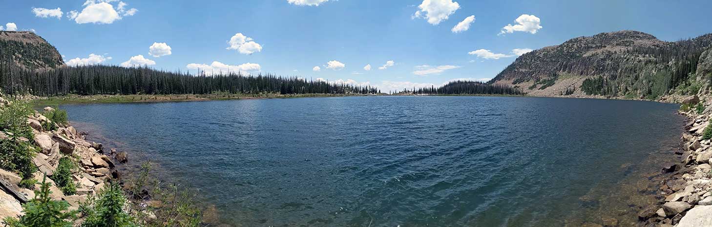
BIG ELK RESERVOIR, A-18. 30 acres, elevation 8,032 feet, maximum depth 107 feet, 8 miles west of Trial Lake, trail becomes very rough and difficult to follow past Island Lake. Access is also available from Norway Flats 3 miles north on old wagon road then a steep climb to lake. Excellent fishing after July 15 for large cutthroat and Arctic grayling. Lake is seldom visited. Good campsites and some horse feed. Subject to great drawdown.
1999
BIG ELK, A-18. Big Elk has a large dam across the outlet and is situated at the base of a steep ridge with talus slopes. It is 30 acres maximum, 10,020 feet in elevation, with 85 feet maximum depth. The two major routes of access are the Norway Flats Road and the Lake Country Trail. From U-150, proceed north on the Norway Flats Road for 7 1/2 miles to the end and then 1/2 mile beyond on the Norway Flats Trail. The last mile of road is passable to 4-wheel drive only. Access is also available from the Crystal Lake Trailhead on 7 miles of the Lake Country Trail. The trail becomes indistinct and difficult to negotiate on horseback between Island and Big Elk lakes. There are several camping areas to the south and east of the lake. Spring water and horse feed are unavailable in the immediate vicinity. Big Elk contains populations of brook and cutthroat trout. Fishing pressure is heavy.
The Dam
The dam was built by Washington Irrigation Company. Which was a group of farmers. Construction of the dam upon Boulder Creek was started in 1910. The plans for the dam called for a flood of 87 acres of land and a maximum capacity of 871 acre-feet. Construction took several years to complete.
Nearby Places to Fish
South Erickson Lake W-25, North Erickson Lake W-26, Little Elk Lake A-19, Hourglass Lake A-48, Lower Shingle Creek P-62, East Shingle Creek Lake A-39, West Shingle Creek lake P-60, Beaver Lake A17, Duck Lake A-7, Fire Lake A-14, Island Lake A-57, Ramona Lake A-38, Weir Lake A-50, and Majorie Lake A-12.