
Directions
South Erickson Lake W-25 is located in Summit County, Utah. The lake is part of the Uinta-Wasatch-Cache National Forest and lies in the Weber River Drainage. The lake can be accessed from three separate hiking trails. I've put them in order from the routes I recommend.
The Journey
Upper Setting Trail. 5 miles.
The Upper Setting Trail is the easiest hike to the lake. From Mirror Lake Highway take the Upper Setting Road for 6.7 miles until the road end. The road can get a bit rough the last mile or two and a medium clearance vehicle is recommended. The Upper Setting Trailhead starts at the end of the road. The hike is 2.5 miles each way, 5 miles round trip and has a 690 ft elevation gain. The first 1.6 miles to East Shingle Creek Lake is a really mellow hike. Once you get past East Shingle Creek the elevation changes quickly. I had to stop for a rest many times in that area. Although the trail was easy to follow. The last quarter mile I lost the trail a few times and had to pull out my GPS.
North Erickson Lake Trail, Erickson Basin Trail, and Smith and Morehouse Lake Trail. 10.1 miles.
This hike goes by a few different names but has the same trailhead and trail. On the south end of Smith and Morehouse Lake the trailhead starts near LedgeFork Campground. Of the three routes this is the best one for a lower clearance vehicle. The trail is about 5 miles each way and 10.1 miles round trip. A GPS is recommended for this hike. There are some cairns (rocks stacked) along the way you can use for navigation. The basic route follows Smith and Morehouse Creek and then Erickson Creek. The Elevation gain is 2,384 feet and most of it happens the last two miles.
Big Elk Lake via Norway Flats. 7 miles of hell.
This terrible road has sharp slate rocks which often pop tires. The hike is pretty much as horrible as the drive up. You should not go this route. You will need a high clearance vehicle with spare tires. From Mirror Lake Highway take the turn to Norway Flats. Follow Forest Road 035 for 5.4 Miles and turn onto Forest Road 916 and park at the pond a few hundred yard up. It is possible to keep going up Forest Road 035 past this spot, but you're stupid if you do. If you're stupid and keep driving up DO NOT TAKE FR 035B, stay on 035A.
From the Pond at Forest Road 916, hike up the hill to Little Elk Lake, then follow FR 035 up to Big Elk Lake. This distance is 2.5 miles. From Big Elk Lake the trail is pretty hard to find. You will go 300 feet in elevation in .3 miles. We got lost a whole bunch of times and easily turned this into a mile and a half. In 2020 when I last did this hike there were some cairns (stacked rocks) marking the best route. I highly suggest you follow these. You will pass a couple of salamander ponds. It look like you're almost over the pass several times then you get over a hill and see several more. According to the map it is only 1 mile from Big Elk Lake to South Erickson Lake.
Fish Species
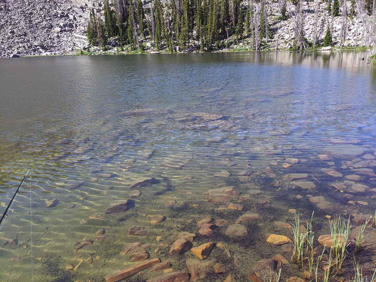
Brook trout are stocked every 2 to 3 years. The average stock is around 850 fish, and the average size is 2.5 inches. When I was last here in 2020 the water was crystal clear and you could see fish swimming in some areas.
Historical DWR Info
1964
ERICKSON NO. 1, X-6. An open lake sitting in rocky country. 5 miles on poor trail from Trial to Big Elk, then 1 mile northwest over ridge. 16.0 acres, elevation 9,500 feet, maximum depth 12 feet, average depth 6.5 feet. Eastern brook and cutthroat to 12 1/2 inches. Stocked. Some horse feed.
1999
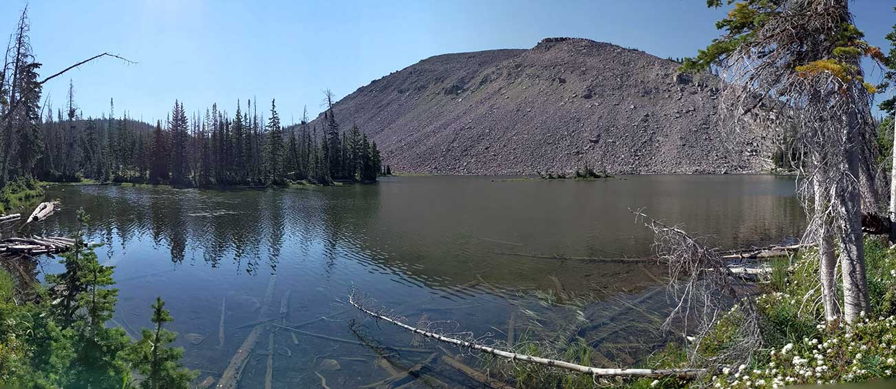
ERICKSON, SOUTH, W-25. South Erickson is a natural lake abutting a talus slope at the head of Erickson Basin. It is 10 acres, 10,100 feet in elevation, with 12 feet maximum depth. The lake contains a fine suspended glacial material giving it a milky green appearance. Access is 2 1/2 miles northeast of the Upper Setting Trailhead on the Upper Setting and Erickson Basin trails (see Provo Drainage Map). Access is also provided by the Smith Morehouse and Erickson Basin trails from the Erickson Basin Trailhead in the Ledgefork Campground vicinity. Campsites are present but running water is unavailable. Horse feed is present to the east at the base of the talus slope. South Erickson is stocked with brook trout. Recreational use is moderate
Nearby Places to Fish
North Erickson Lake W-26 is a 1/4 mile north downhill from the east side of South Erickson. The Erickson Basin Trail is supposed to lead between the two lakes but I couldn't find it the last time I was there. Big Elk Lake A-18 is 1 mile around the hill down some pretty serious cliffs. Aim for the east side of Big Elk Lake on this hike so you don't get lost for two hours like I did. Also make sure you follow the cairns as the trail is no longer findable.
Following the Upper Setting Trail to the west you can access East Shingle Creek A-39, and West Shingle Creek P-60. Other nearby fisheries include. Castle Lake W-51, Little Elk A-19, Hourglass Lake A-48, Beaver Lake A17, Duck Lake A-7, Fire Lake A-14, Island Lake A-57, Ramona Lake A-38, Weir Lake A-50, and Majorie Lake A-12.