
Directions
East Shingle Creek Lake A-39 is located in Summit County, Utah. The lake lies within the Uinta-Wasatch-Cache National Forest and is in the Provo River Drainage.
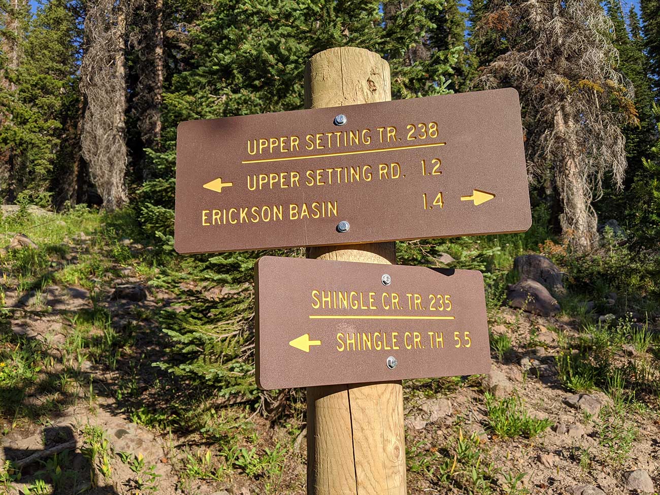
From Kamas take the Mirror Lake Highway road for 8.7 miles. You will turn on to the Upper Setting Road and there is a sign. The Upper Setting Road is just past the two Yellow Pine exits. Follow the Upper Setting Road also known as Forest Road 034 for 6.7 miles. There is a cattle gate about half way up that you will have to open and close. When I was last on the road in the summer of 2020 it was in really good condition. You could have taken a lower clearance SUV with no issue. There are a few reports online saying that the last two miles of the road can get ugly and will sometimes require a high clearance vehicle. There is a small parking area that can fit around 5 to 10 cars. This is where the trail head begins.
The Upper Setting Trail Hike
The trailhead starts at the end of Upper Setting Road. The total hike is 1.6 miles and only gains 274 feet in elevation. I saw several small children that were able to make the hike. This is a popular hike and the trail leading to the lake is easy to follow. Stay on the Upper Setting Trail all the way to the lake. A quarter mile before the lake you will see a sign for a trail called Shingle Creek. The Shingle Creek Trail leads back down to Mirror Lake highway so don't take it.
Shingle Creek Trail
One alternative hike in is called Shingle Creek Trail. Unlike the Upper Setting Trail the Shingle Creek Trail starts right on the Mirror Lake Highway. This is one of the earlier season trails you can access, when snow is still blocking most the mountain. The Hike is 6 miles each way. You can find more info on the Shingle Creek Trail on Girl On A Hike's page.
Fish Species
Tiger trout is the most likely catch and brook trout is a possible catch. On average this lake is stocked with only about 400 tiger trout. Due to the limited fish stocked and the heavy traffic area, fishing can be poor. Typically stocked every two to four years.
Nearby Places to Fish
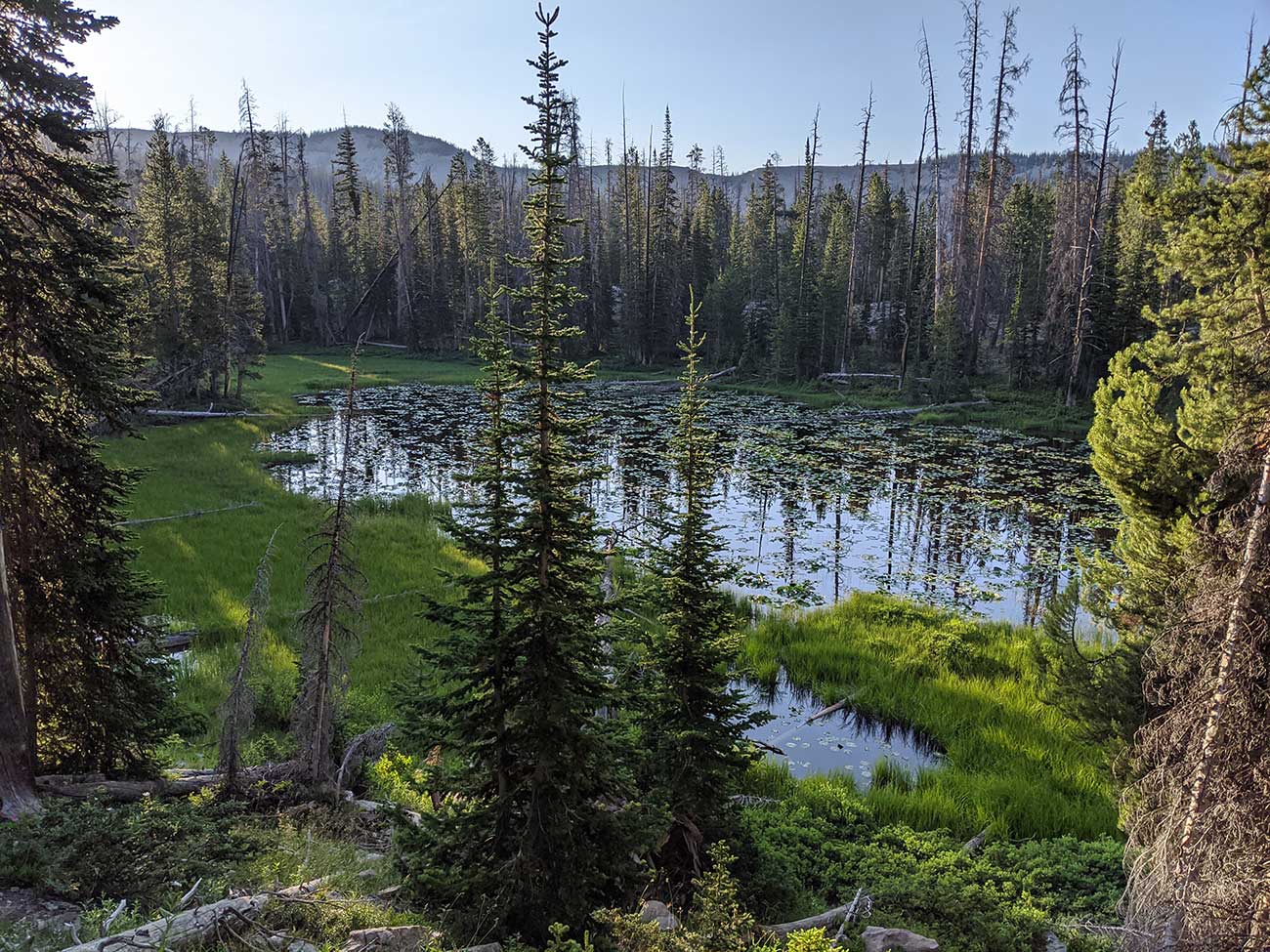
West Shingle Creek Lake P-60, Lower Shingle Creek Lake P-62, South Erickson Lake W-25, North Erickson Lake W-26, Castle Lake W-51, Big Elk Lake A-18, Little Elk Lake A-19, and Hourglass Lake A-48.
DWR Historical Info
1964
A-20. 7 acres, maximum depth 44 feet, average depth 25 1/2 feet, elevation 8,800 feet. A very difficult lake to locate. 6 miles north along Shingle Creek Trail which starts on Highway 150 west of Norway Flats Road. Lake lies west over high ridge from Norway Flats. Stocked with brook. Fishing should be excellent as very few people visit this lake. Good campsites.
1999
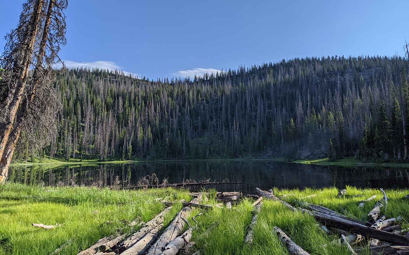
East Shingle Creek Lake A-39. Is a deep, natural body of water situated at the head of Shingle Creek. It is 7 acres, 9,700 feet in elevation, with 44 feet maximum depth. The lake is surrounded by thick timber with scattered small meadows. Access is 6 1/2 miles north of U-150 on the improved Upper Setting Road to the trail-head and then 1 miles northeast on the Upper Setting Pack Trail.
Access is also provided by the Shingle Creek Pack Trail from U-150, but hiking distance is much greater. Several campsites with spring water are available. Horse pasture is limited in the lake vicinity. Angling pressure is heavy due to the accessibility of this lake. In addition to brook trout, splake (a brook trout - lake trout hybrid) were introduced to help control a population of redside shiners.