Directions
Bourbon Lake also known as BR-1 and Gold Hill is located in the Summit County, Utah. The lake lies withing the Bear River drainage of the Uinta Mountains. From Salt Lake City you can get to the trailhead via Kamas and the Mirror Lake Highway. The trailhead is across the street from the Sulphur campground and in between the turn off to Ruth Lake and Whitney Reservoir. From Salt Lake it takes a little less than 2 hours via the Kamas route and about 2 hours and 20 minutes via Evanston, Wyoming.
The Hike 2.8 miles round trip
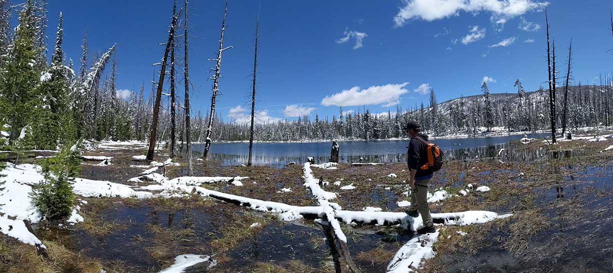
The trailhead begins right from the parking turn off at Mirror Lake highway. The trail head is called Whiskey Creek Trail and there is a sign. The trail follows Whiskey Creek for the first half of the hike, then heads west towards the two lakes. BR-2 is a smaller lake about 300 feet southeast of Bourbon Lake and is definitely worth stopping at. The hike only gains about 680 feet of elevation from beginning to end. This makes for a pleasant hike that most average people should have no problem with. On our way out we stopped by BR-50. There is no trail to BR-50 and you will likely need a GPS to find it.
Fish Species
Bourbon Lake is stocked with brook trout on a 4 year cycle. 2012, 2016, and 2020. The average size fish is stocked is 2.5 inches, and the around 200 fish stocked each time.
BR-2 is stocked with brook trout on a 3 year cycle. 2013, 2016, and 2019. Before 2013 the lake had not been stocked for a few decades.
BR-50 is stocked with brook trout on a 3 year cycle. In 2012 stocked with 608 fish, in 2015 stocked with 960 fish, and in 2018 it was stocked with 1150 fish. Marshes and downed trees make this lake difficult to fish.
Other Info
You can read more about the hike at Girl On A Hike and Utah's Adventure Family. Gold Hill lies to the north west about 2 sky miles. Deseret News had a good story on legends of gold in the area.
Historical Information
From DWR pamphlet 1985.
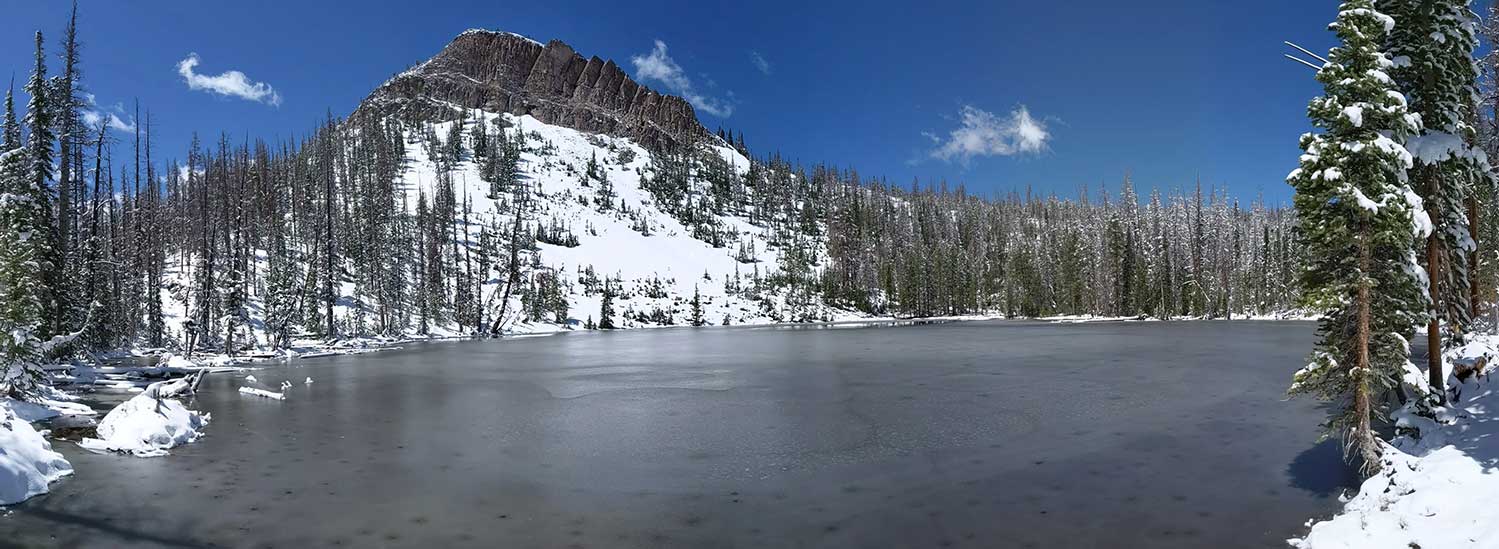
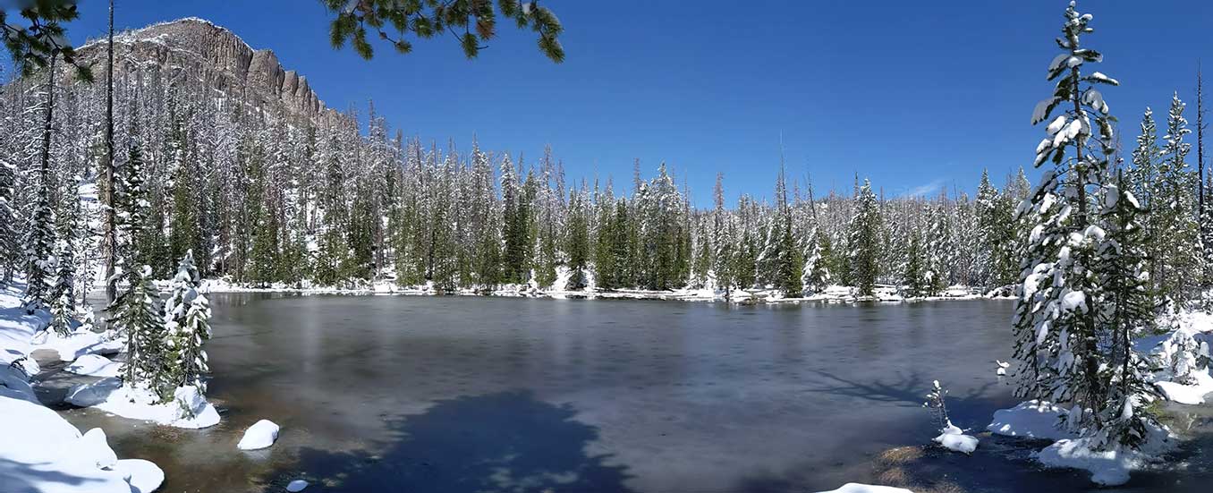
BOURBON (GOLD HILL), BR-1. Bourbon is a small crescent-shaped lake in timbered country at the foot of a steep, jagged peak and associated talus rock. It is 1.9 acres, 9,820 feet in elevation, with 8 feet maximum depth. Campsites are poor in the lake vicinity, but a spring water source is available. Bourbon is located 1 steep mile west of Highway U-150 on the Whiskey Creek Trail which begins across the highway from the Sulpher Campground. Access is also afforded by the Whiskey Creek Road which begins across the highway from and slightly north of the Kletting Peak Information Turnoff. Follow this road north and west for 2 and 1 half miles to the end and then continue northwest on foot for 1/4 mile to the lake. Bourbon, containing a population of brook trout, is a popular fishing spot.
BR-2. This productive meadow pond is located some 100 yards downstream from Bourbon Lake in the Hayden Fork of the Bear River Drainage. It is 0.7 acres, 9,780 feet in elevation, with 5 feet maximum depth. Small and quite shallow, BR-2 would not appear to provide suitable fish habitat. However, the lake contains a population of brook trout sustained by natural reproduction and downstream migration from Bourbon Lake. Camping opportunities are available with a limited supply of horse feed. Spring water is available at Bourbon. Fishing pressure is light despite the easy access afforded by the Whiskey Creek timber road.
From DWR pamphlet 1964.
GOLD HILL, BR-1. 2 acres, elevation 9,600 feet, maximum depth 12 feet. 1 almost vertical mile southwest of the Sulphur Campground on the Hayden Fork Highway 150. Very steep, rugged, heavily timbered terrain. No trail to the lake. This picturesque, crescent shaped lake lies directly below the "white ledges.” Poor campsites and no horse feed. Clear water with wary brook trout. Not frequently fished.
BR-50 Max depth is 27 feet.
Nearby Places to Fish
Whiskey Island Lake, Whitney Reservoir, Beaver Lake, Fish Lake, Round Lake, Sand Lake, Ruth Lake, Hayden Lake, Cutthroat Lake, Hell Hole, and Lily Lake.