
Directions
Rock Lake A-10 is located in the Provo River Drainage of the Uinta mountains. This lake lies in Summit County, Utah. It can only be accessed by hiking. The lake lies between Azure Lake and Shadow Lake and is surrounded by a huge boulder field. You can access the lake via the Spring Canyon Road also known as FR-041. This road is a loop and has two entrances from Mirror Lake Highway. The first is known as the Alexander Lake access and is the southern most access point. The faster access point would be from the Trial Lake exit.
From Mirror Lake highway take the Trial Lake exit and continue on FR-041 for 2.2 miles. This will put you at the trail for Haystack Lake which is my preferred route. Last time I was here in 2025 the trail marker was gone and it was difficult to see the trail head without GPS.
The other route is from Beth Lake. Continue past the Haystack Lake trail head a half mile on FR-041 and take FR 961 to Beth Lake. There is a small parking lot at Beth Lake.
The Hike
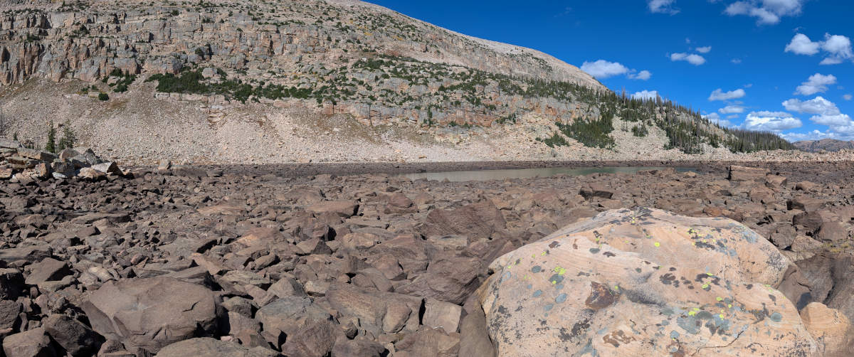
HIKE WARNING. Do not attempt this hike if you’re not in great shape or do not like scaling over hundreds of giant boulders. I strongly recommend you do not take small children on this hike as it can be dangerous.
I recommend entering from the south side of Azure and then walk along the shore of Azure Lake to the north west end. Entering from the south side can bypass some of the boulder field. From here you will hop over a few hundred boulders until you’re at Rock Lake. The directions below are the directions to Azure Lake.
From Haystack Lake
From the south side of Haystack Lake there is a small cattle fence. It runs somewhat east to west. This fence pretty much points to Azure Lake. You can walk along the fence which will end you will keep heading west towards Haystack Mountain. The first part of the hike goes straight up a hill but isn’t hard. The last 10% of the hike is going over large boulder field known as Raspberry Rock Fields. If you head south once you see the boulders you should be able to miss a majority of the rocks.This will have you enter Azure Lake from the south side. There is a flat and easy going trail once you hit azure that you can follow to the northwest side of the lake. From here you will have to hop over a bunch of boulders for a few hundred feet.
From Beth Lake
From the parking lot on the east side you will head west past Beth. You want to aim for the trees on the north as there are a lot of marshes near Beth that will soak your legs up to your shins. Head towards Haystack Lake to avoid the marshes until you’re past Beth. Then head west towards Haystack Mountain. Just look for the tallest peak and head that direction.
The Raspberry Rock Fields
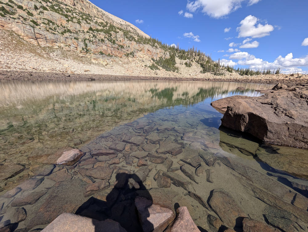
The lake and surrounding area is covered in these large boulders. When I was here in 2025 we did find some wild raspberry plants in the boulder fields. There are thousands of these giant boulders and some pretty narly holes that you can easily fall in and cripple yourself.

Fish Species
The lake is stocked every other year with tiger trout. The fish are easy to see swimming around in they crystal clear water. Tiger stocked in 2025, 2023, 2021, etc. Due to the naming confusion there might just be arctic grayling here.
Historical DWR Info
1964
ROCK, A-ll. (Also called Lock Lake.) 3 acres, elevation 10,000 feet, maximum depth 22 feet, average depth 13 feet. 1/2 mile west of Haystack No. 1 and north of Azure Lake 200 feet. Stocked occasionally with brook trout.
1999
ROCK, A-lO. Rock is a natural lake situated in rough terrain at the base of Haystack Mountain, 3/8 mile west of Haystack Lake. It is 8 acres, 10,140 feet in elevation, with 14 feet maximum depth. Rock has a history of winterkill. Several good campsites are available with limited spring water. There are no clearly defined trails, and access is limited to backpackers due to the rough nature of the terrain and large rock slides. Angling pressure is moderate. Rock Lake receives frequent plants of brook trout, but fishing is unpredictable.
Rock or Azure?
Originally the names of Rock Lake and Azure Lake were flipped on the map. Which you can see from the two DWR Lake of The High Uintas pamphlets I quote above.
According to a Deseret News article from 1997.
Visiting officially named Azure and Rock lakes shows why the names should be reversed.
Located less that 100 yards from each other, the eastern lake – Azure – is actually the one with rocks all around it and even a few large boulders cropping up in the water. Rock Lake to the west, meanwhile, has grasses growing all around it and is partially surrounded by pine trees.
Clegg said this misnamed Rock Lake is the true Azure Lake because of the poignant sky-blue color it assumes under a clear sky.
Nearby Places To Fish
Azure Lake is a short hike to the south. Access from the south east side of Rock Lake to try and avoid the Rasberry Rock Field.
Shadow Lake is located a few hundred yard north of Rock Lake and across a bunch of boulders. Other nearby Lakes are listed on the map below but include.
Haystack Lake, Beth Lake, Blue Lake, Tail Lake, Washington Lake, Trident Lake, Buckeye, Spectacle, Alexander, Lambert, and Trial.